Top Hikes Out the Backdoor
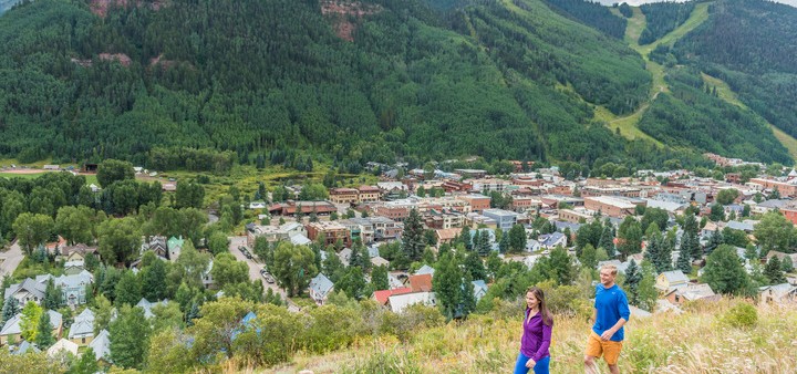
Trails in the mountains surrounding Telluride and Mountain Village offer hikers everything from a quick jaunt to a waterfall to a day-long high-altitude adventure complete with mining ruins, high-alpine meadows strewn with wildflowers and the stunning scenery of the San Juans. Both Telluride and Mountain Village have trails that start right in town. Here are our favorites, right outside your backdoor.
The Jud Wiebe Trail. This popular, sunny, 3-mile loop begins and ends right in town with trailheads at the top of North Aspen and North Oak streets. Either way, the Wiebe begins with strenuous, steep uphill walking at the beginning, although starting your hike at the North Aspen end makes for a slightly less challenging climb at the beginning. Hikers eventually reach the summit ridge with beautiful, panoramic views across the Telluride valley that take in Bridal Veil Basin, Upper Bear Creek, the Telluride Ski Resort and west to Wilson Peak. Drop back down into town, just in time for whatever your day has in store.
Sneffels Highline. A strenuous but memorable hike that begins right in town. Thirteen miles long with an elevation gain of more than 3,000 feet, the route takes hikers through stands of wild strawberries and aspen groves, under cliff bands, through scree fields and on to high-alpine meadows where the wildflowers sometimes stand waist- to shoulder-high. Watch for elk and other wildlife, and pause to take in some pretty sick views. Begin on the Jud Wiebe Trail at North Aspen Street. When the Wiebe goes right, you turn left at the Mill Creek sign, using a guide book or map to follow this long route that has variations.
Cornet Creek: Looking for a pre-festival quickie? This short half-mile hike takes just an hour at most, but offers the stunning payoff of dramatic Cornet Falls. The trail begins at the end of Telluride’s North Aspen Street. While the Jud Wiebe Trail follows the steel bridge across the creek, stay to the right-hand side of the red clay-and-rock bed of Cornet Creek. At times, hikers may need to scramble and use their hands on the steep hillside above the creek, as all the while the rush of the falls grows steadily louder. Arrive at the end of the slot canyon to see the cascade, which can vary from a partially frozen trickle to a torrent depending on the time of year and the snow melt from the terrain above.
Wasatch Trail via Bear Creek: This challenging circuit – which includes strenuous climbs and rugged terrain along its 14-mile route – has it all, from the quiet beauty of Bear Creek Canyon, to the historic ruins of Nellie Mine and on to the remote and rugged Bridal Veil Basin, with hikers at times surrounded by wildflowers in a riot of color. The trailhead is 2 miles up Bear Creek where the right turn is well marked. Ascend numerous, steep switchbacks, pass Nellie Mine and hike on to Lena Basin before staying left and ascending to the saddle. Continue down into Bridal Veil Basin, dropping all the time until you arrive at the top of Bridal Veil Falls. Pick up Black Bear Road to loop back into town. This is a complex route that requires a good map or guidebook.